

We hear, formulate and implement each solution for you with our advanced geospatial expertise. Our solutions are carefully designed to help you today, tomorrow and for many years to come.
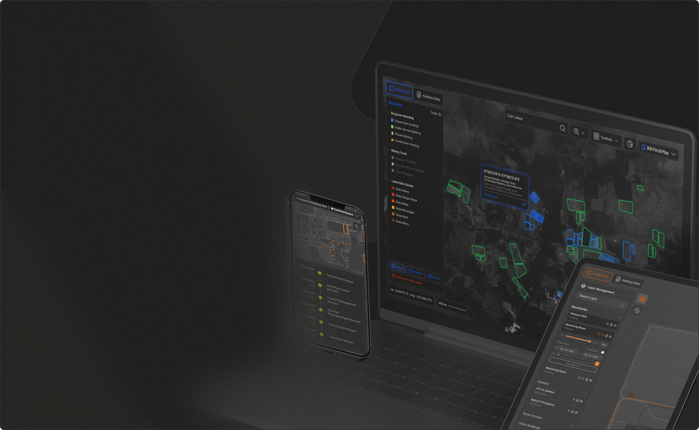
Analyze site conditions, measure key urban indicators, and perform spatial analysis — directly in the browser.
Go to GeoDashboardVisualize multiple layers both vector and raster to perform a detailed, precise, and insightful analysis.

Easily visualize data in point, polygon and polyline format. Inspect rich data display for each attribute.

Created in no time through bootstrap. Get all the desired features, tailored to your needs.

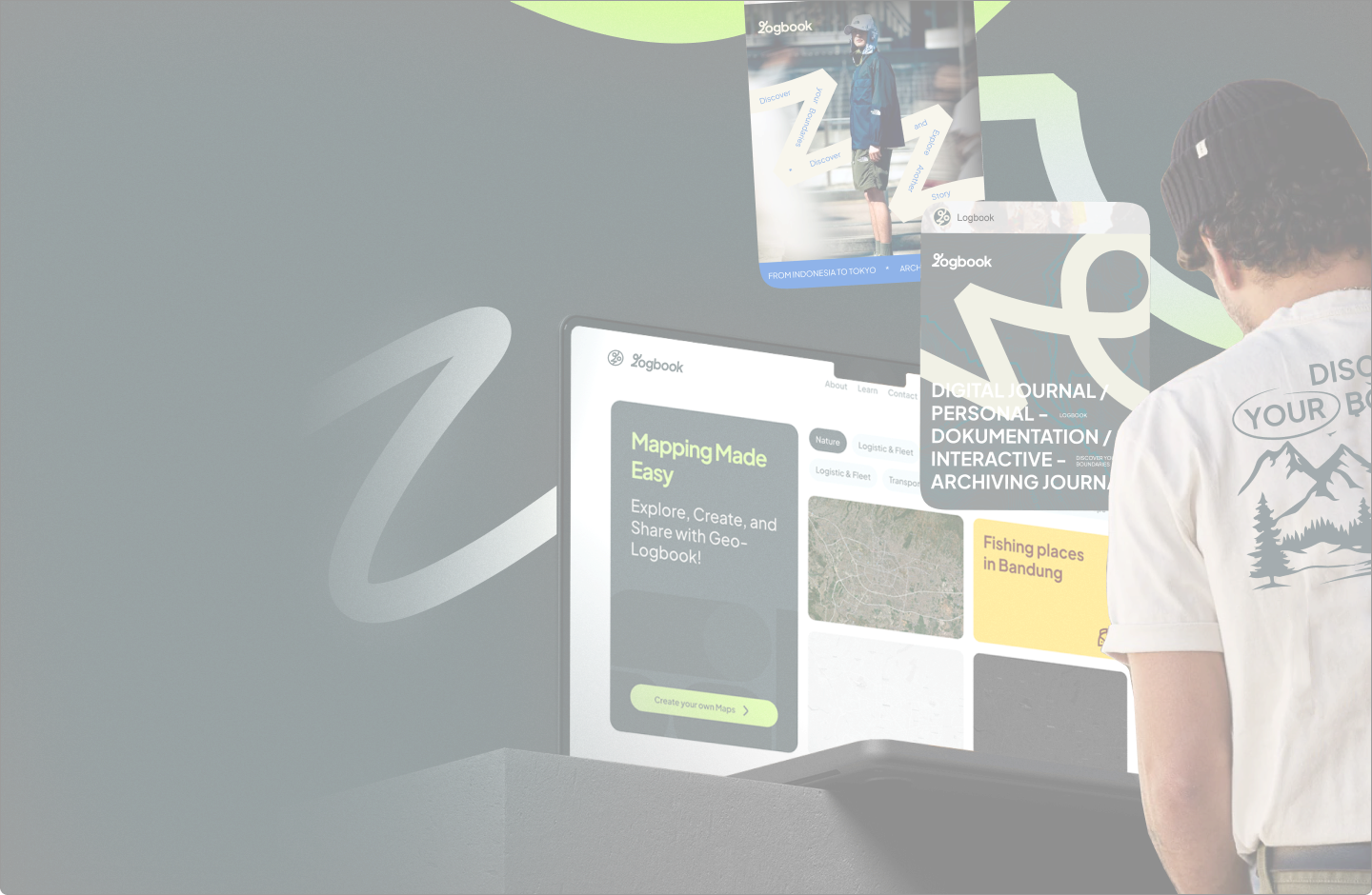
Stay tuned for the unveiling of our meticulously crafted logbook – where every entry marks a step toward unparalleled organization and memorable experiences. Launching soon!
Go to LogBookStreamline your storytelling process with our intuitive tools, enabling you to convey your message effectively.

Express your individuality through meticulously crafted maps tailored to your personal style and identity.

We have mapped and navigated in multiple parts of the globe across various fields and industries as a testament of how universal geospatial technology is.
Retail and Real Estate
Oil, Mining, and Gas
Logistics and Fleet
Agriculture
Our interdisciplinary design and development approach accelerates the geospatial tech delivery to your hands.

Ministry of Environment and Forestry (KLH)
Sistem Visualisasi dan Analitik Penegakkan Hukum Kehutanan di Indonesia - Read MoreMinistry of Environment and Forestry (KLH)
Geospatial Dashboard untuk Monitoring Emisi dan Kualitas Lingkungan - Read MoreBadan Nasional Penanggulangan Bencana (BNPB)
Sistem Peringatan Dini Banjir untuk Wilayah Bekasi - Read MorePT. Borneo Indobara
Digital Twin Platform untuk Pertambangan dan Safety Monitoring - Read MoreThe Ministry of Public Works (PUPR)
City Information Modelling (CIM) - Read MoreMinistry of Agrarian Affairs and Spatial Planning / National Land Agency - ATR/BPN
Geospatial Dashboard for National Land Governance - Read MorePT. Borneo Indobara
Single Source of Truth Dashboard for Enterprise Geospatial Data - Read MorePT. Borneo Indobara
Real-time Geotechnical Monitoring and Risk Management System - Read MoreNational Agency for Disaster Management - BNPB
Early Warning System for Cold Lava and Flood Monitoring - Read MoreMinistry of Agrarian Affairs and Spatial Planning / National Land Agency - ATR/BPN
Digital Land Information & Certificate Verification System (BHUMI) - Read MoreNational Agency for Disaster Countermeasure - BNPB
Multi-Hazard Early Warning System - Read MoreExplore detailed information about Braga Technologies, including our core services, industry expertise, implementation methodology, and long-term partnership approach. This section is intended to provide clarity on how we deliver scalable digital and geospatial solutions that meet business and operational needs. For further inquiries, our team is available to provide direct assistance.
Braga Technologies (PT Braga Teknologi Nusantara) is an Indonesian technology company based in Bandung that specializes in geospatial technology and location-based services. Founded in 2019, the company focuses on transforming complex spatial data into actionable insights to improve decision-making for businesses and government agencies.
Yes. Braga Technologies is the company, and GeoDashboard is the platform developed and delivered by Braga Technologies as a core solution for Web GIS and Geo-AI implementations.
Braga Technologies is ISO 27001 certified and applies security best practices across development and deployment. We also maintain GDPR compliance awareness where relevant, especially when handling personal or sensitive data. Security controls are aligned to client requirements and may include role-based access control, auditability, secure API practices, encryption in transit, and vulnerability hardening as part of delivery.
Braga Technologies has delivered GeoDashboard-based solutions, often enhanced with AI/Geo-AI capabilities across multiple domains, including environmental and forestry analytics dashboards, disaster information systems, early warning platforms, carbon monitoring dashboards, and mining monitoring solutions (as showcased in the company profile). AI components may include automated data extraction, anomaly detection, classification, and AI-assisted analytics to accelerate insight generation and decision support.
GeoDashboard is commonly used for location-based monitoring and reporting, environmental and climate data visualization, and natural resource analytics through interactive dashboards. It also supports risk monitoring and early warning systems, integrates field data collection with maps, and enables cross-agency geospatial data consolidation for more informed decision-making.

Find out how you can maximize the value from data and strengthen your decision making
Indonesia's Leading Geospatial Technology that optimize analytics and performance, moving the world one map at a time.
LinkedIn Youtube
© Braga Technologies 2024
Back to top ↑ Information Security Policy Terms and Condition